By far the most common question that gets asked of the Hema Map Patrol is ‘how do I get your job?’
Whether pulling into a remote bush-camp in Central Australia or checking social media comments in the office, people are always telling us we’re some of the luckiest folks around.
Like any other job, however, riding in the Map Patrol isn’t exactly a paid holiday. And even if you land a job at Hema, it may be a while before the opportunity to climb into one of the work wagons presents itself. So, what exactly does it take to score a seat on the Map Patrol?


THE GUISE
I’d been working as an editor for Hema just shy of a year before I got my chance. The primary function of any Map Patrol outing, the thing that puts diesel in the tank and keeps the office lights on, is to collect data. Data wasn’t my thing, but I figured I knew how to string a sentence together and I could point a camera with some degree of accuracy.
So why not pitch a story explaining what it takes to get that coveted spot and what it is that the Map Patrol do when they’re out on the road?
This would mean I’d have to see it firsthand, of course; this was my ticket onto the Map Patrol.
The crew from Camper liked the idea and just like that, the deal was done and my spot on the next Map Patrol outing was secure. I was to ride along for a few days through Rinyirru (Lakefield) National Park, in Queensland, with Bryce and Tim, and hopefully return with a story or two worth telling.
HEADING NORTH
I packed my bags, charged my digital arsenal and hopped on a flight to Cairns early on a Monday morning. Bryce and Tim had driven the main mapping vehicle, Hema’s dual cab LandCruiser 79, from Brisbane over the weekend, so they picked me up from the airport and we were on our way. The run from Cairns to Lakefield takes a good few hours if you’re planning to enter from the southern end of the park. We, however, were aiming for the north-west entrance, which made for six or so hours of transit.
I didn’t know either of my trip companions all that well, since we work in different parts of the business. I’d been based in our Melbourne office until only a month beforehand. This transit run, it seemed, was the perfect opportunity to find out how these two found themselves in this position.
Bryce is the fieldwork guy. One of his main roles is to organise the trips, create detailed itineraries and figure out budgets for the Map Patrol’s sojourns — his is the job that people envy most. I knew his email signature identified him as a cartographer and geographic information system (GIS) analyst.
Bryce’s path, it turns out, wasn’t born out of a schoolboy dream to drive desert tracks in a modified Toyota. He’d earned a science degree before taking up work with a mining company, where he picked up the fundamentals of GIS and data capture through geophysical mining exploration. Compared to some of his previous fieldwork experience, Map Patrol trips are practically luxurious.
Tim, on the other hand, works in the mysterious technical support department; a strange place I tend not to visit, lest I break something or get caught up in the technical wizardry that’s carried out there. On a more relatable note, I knew Tim to be a keen four-wheel driver and I’ve had plenty of conversations with him about the burly Triton he thrashes around on weekends. With Tim at the helm, Lakefield’s toughest tracks would prove to be a comfortable ride.
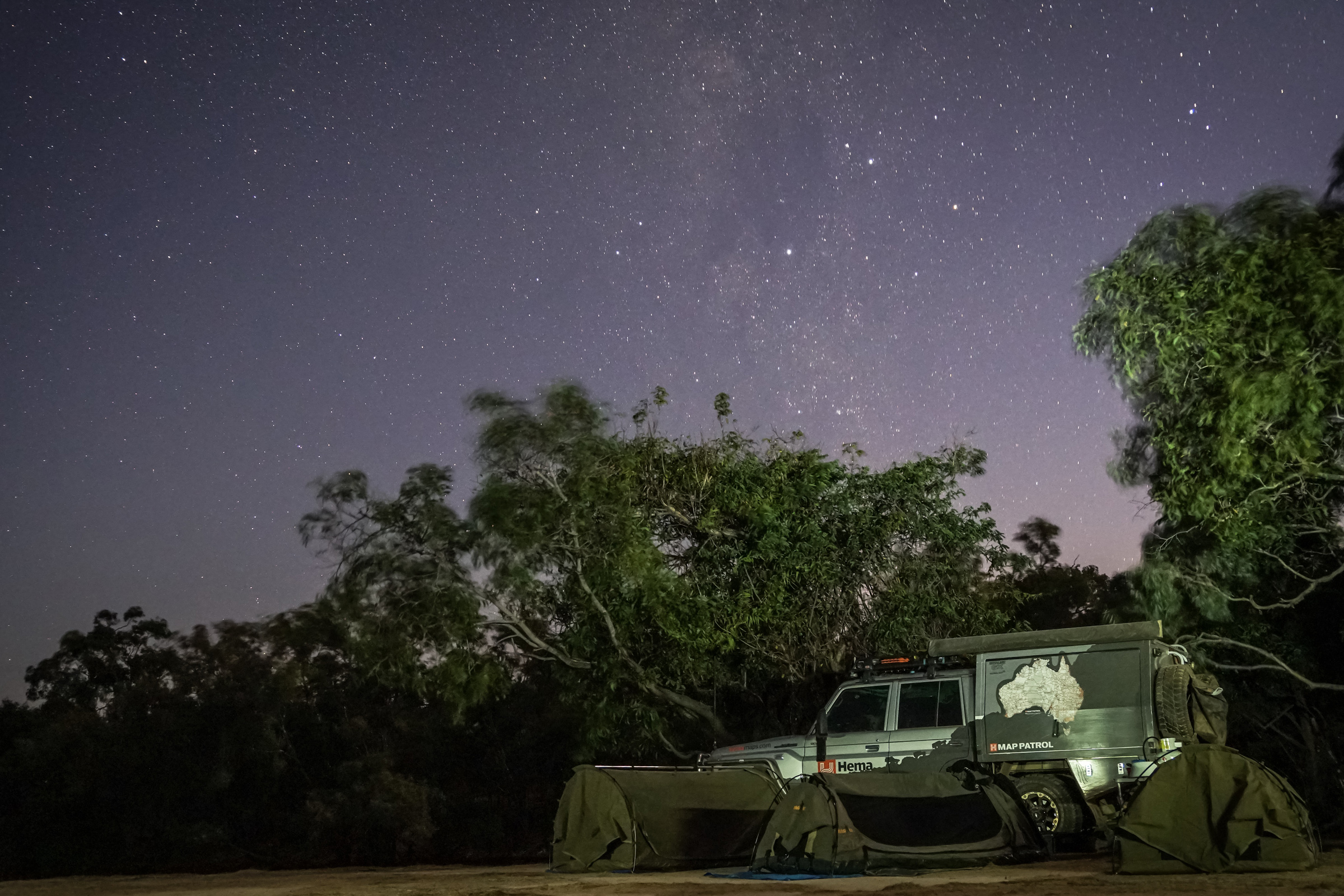
We drove north from Cairns along the Peninsula Developmental Road, eventually unfurling swags at the Musgrave roadhouse, where an eclectic crowd of campers were gathered: dusty-skinned enduro-bike riders returning from the Cape, caravanners passing through on their big lap, a family of birdwatchers from Japan with zoom lenses longer than my forearm and four-wheel drivers of all shapes and sizes.
THE RIG
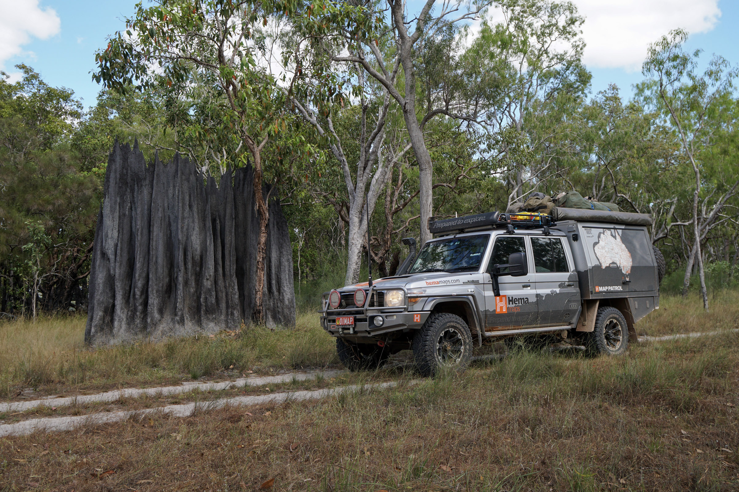
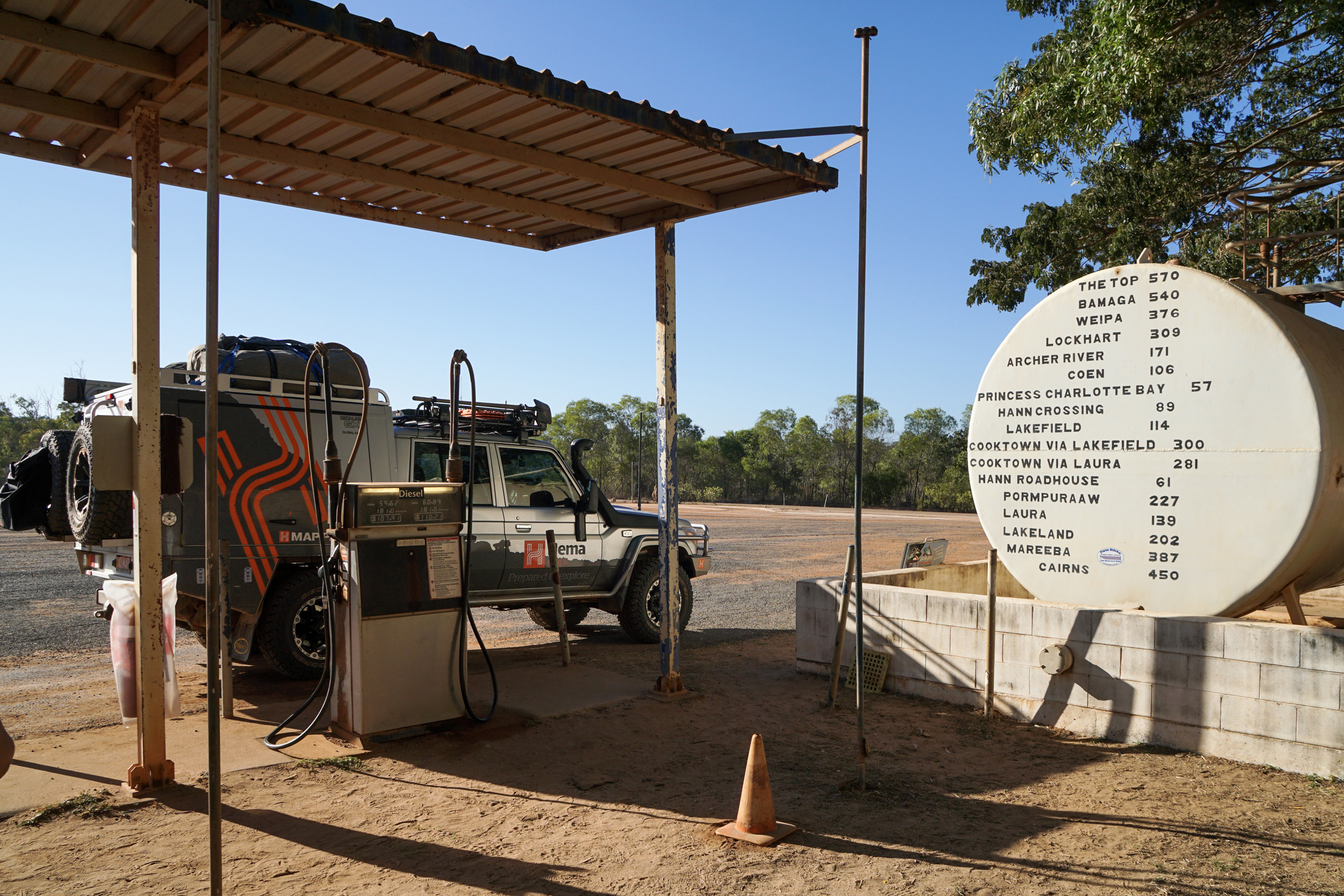
The following morning, we topped off the 79’s 180-litre fuel reserves, plus one extra jerry can just in case, while fielding a few questions from curious passers-by. People are generally interested in what the team are up to when they see a Hema-branded vehicle, but none attract quite so much attention as this beefed up Cruiser.
The LC79 began life as stock standard silver dual cab, chosen for its powerful 4.5-litre V8 engine, rugged simplicity and openness to modification. To facilitate the long list of additions that were scheduled for the factory fresh farm truck, the chassis was strengthened and extended by 200 millimetres, then it was given a GVM upgrade which boosted it close to four tonnes. It was re-laced with new wheels and Cooper S/T MAXX tyres, before rolling down to ARB for a complete kit-out. The crew from ARB loaded some serious steel onto the front and sides and fitted a snorkel and diff breathers. Recovery points were given an overhaul and they wired up a Warn winch for any tricky situations. Finally, a suspension upgrade and some new lights, and it was time for the custom canopy.
The canopy is the LC79’s coup de grâce, allowing the team to live and work in remote areas for weeks on end. There’s plenty of storage space, a kitchen with an 80-litre upright fridge/freezer, shelving, heavy-duty slide drawers and a 90-litre water tank. To keep all the requisite gear up and running, there are two 150-amp hour lithium ion phosphate batteries (there’s also another auxiliary battery under the bonnet), a REDARC power management system, a 1000 watt inverter, data bank and a charging station for cameras, laptops and such — eight 240-volt outlets, 16 DC USB ports, and dedicated camera and hand-held radio cradles. There’s a second inverter in the cabin, as well as a series of alarms that alert the driver to things such as the canopy doors being left open while the engine is running, low-coolant levels and so on.
And if that wasn’t enough, there’s a reversing camera, two sat-phones, a few extra dials, UHF radio, work lights everywhere (even under the bonnet), GPS signal-boosting antennas, and USB ports in every possible location. All up there are 47 marine-grade after-market circuits in the system and more switches than you’d care to count. Since the initial fit-out, some systems have been updated and tweaked to better serve their purpose, but the most notable of all those on our trip to Lakefield National Park was the new system we were using to capture mapping data.
MAKING MAPS
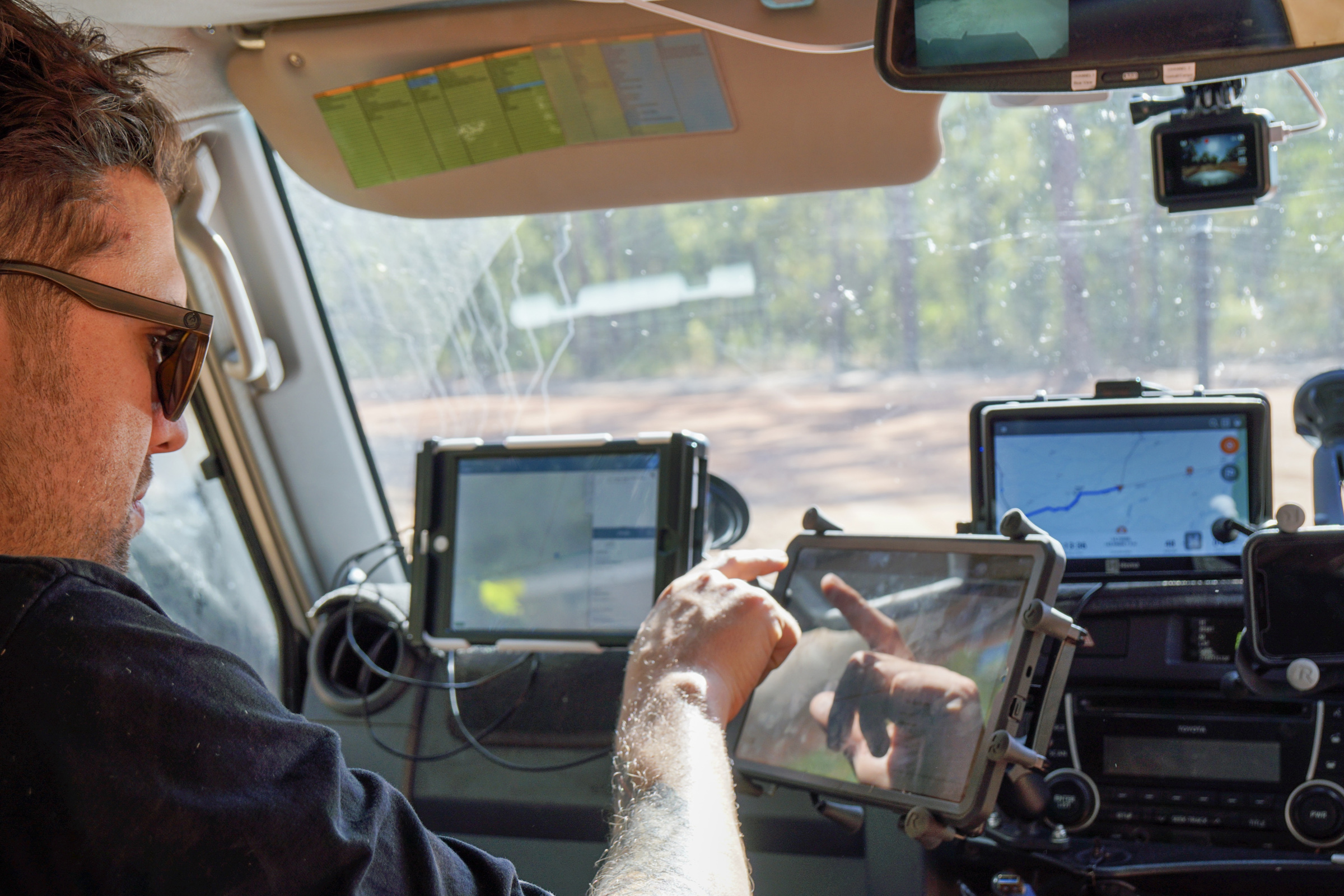
On day two I returned to my spot in the back seat, Tim took up his favourite spot — the driver’s seat — and Bryce was perched in the passenger seat with two tablets mounted before him. These replaced a much more cumbersome system that had previously been fitted in the front, and were also served by a new GPS antenna that provides increased accuracy, from half a metre to around 20 centimetres.
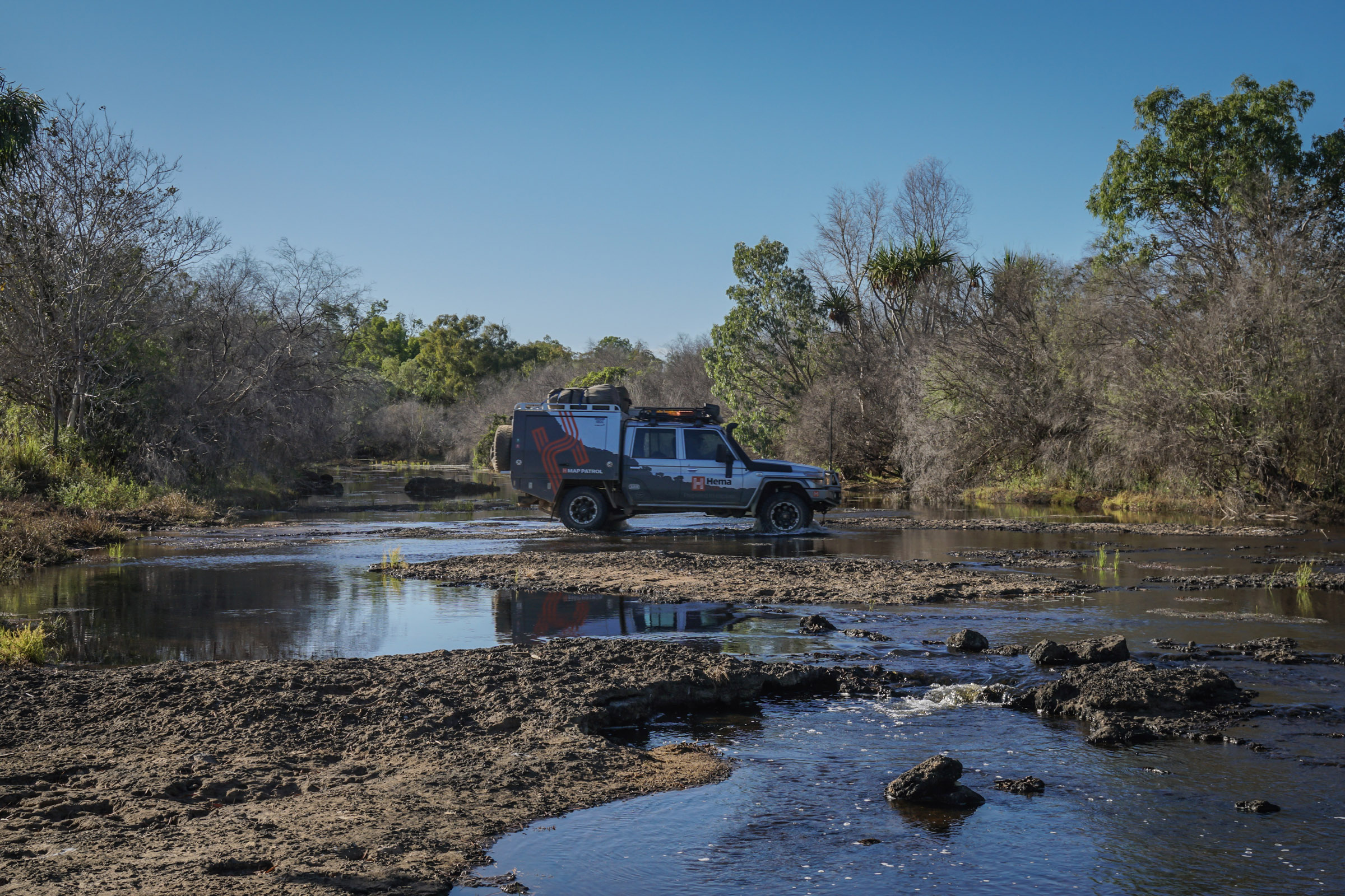
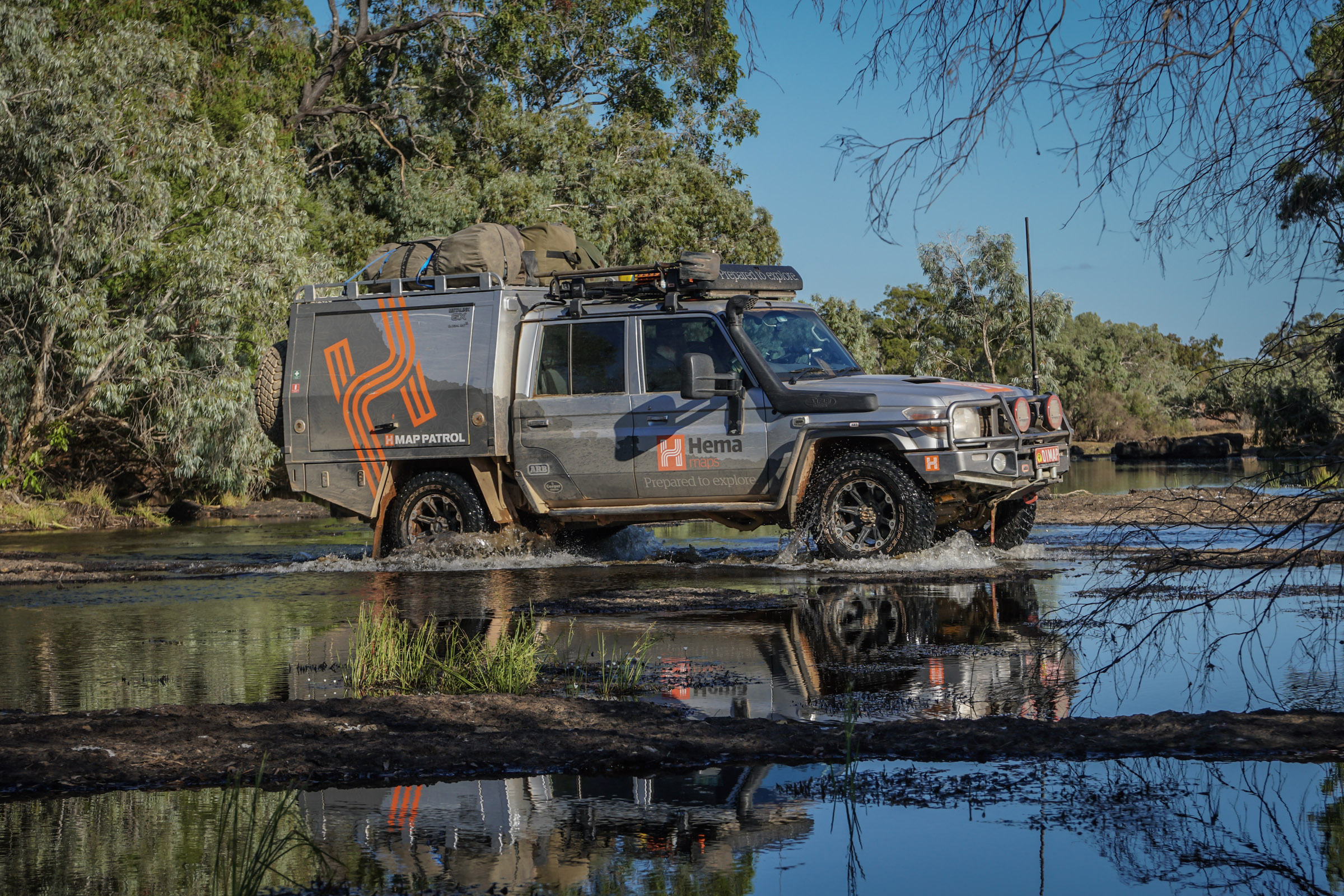
While we cruised along the transit leg, the tablets didn’t receive all that much notice, but once we entered the park, they had Bryce’s undivided attention. One tablet recorded our journey and compared our path to a base map of existing data. Most times we turned from the main track to a side-track, we would stop so that Bryce could ensure each of these were being captured independently. We also recorded on a Hema HX-1 for extra peace of mind. In order to capture them, we’d have to drive every track in the park. In early September this was a simple enough task, since they were dry and in fairly good condition.
But why go to all that effort if we already had that base map data? Because four-wheel drive tracks aren’t like blacktop grids you find in the city. They tend to wander and change from season to season, particularly in a place like Lakefield, which is closed for six months of each year when much of the park is underwater. Some tracks are reclaimed by the bush and disappear entirely, while others change from easy to moderate, or vice versa. Despite this, as day two drew to a close, I realised that capturing the tracks was, in fact, the simple part.
POINTS OF INTEREST
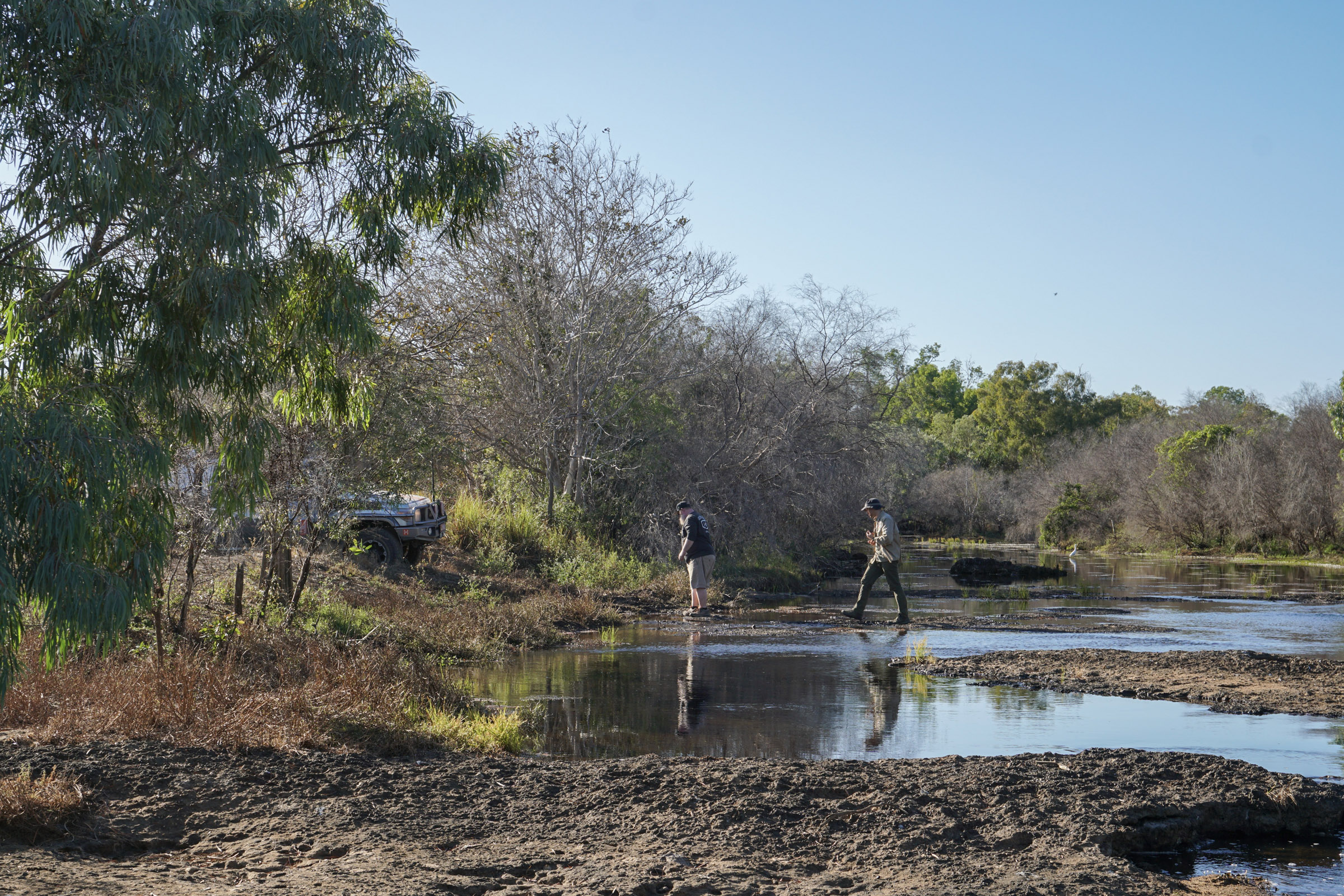
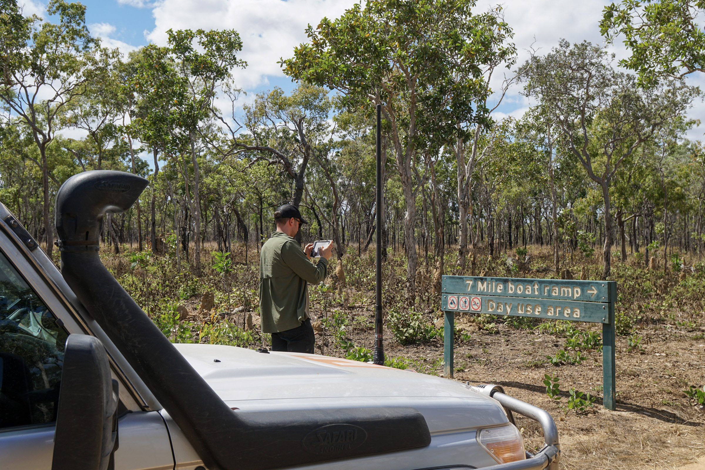
Lakefield National Park contains around 200 individual campsites, spread out over more than 5,000 square kilometres. In order to update our map data for these, we were to drive to each one, where we would stop so that Bryce could hop out, photograph the site and any signage that indicated its presence, record its exact position using the GPS coordinates, and note down any additional features such as boat ramps. All the while, a GoPro mounted on the front windscreen took photos every five seconds as we drove. After entering the park on day two, we’d only managed to capture 18 campsites before the day drew to a close, so we were up before dawn on day three to pick up where we’d left off – I began to suspect that this was tedious business.
As we visited each campsite, we also made notes on track ratings, recorded any river or creek crossings (most were dry at that time of year), and stopped to photograph junction signs and information boards. As if we didn’t have enough scheduled stops as it were, I’d yell “stop, pull up here” every time I saw something interesting that I wanted to jump out and photograph. Some photos would be used for this story, some I knew would be useful for specific purposes in other publications that I was working on, while the rest were destined for our ever-growing editorial image library.
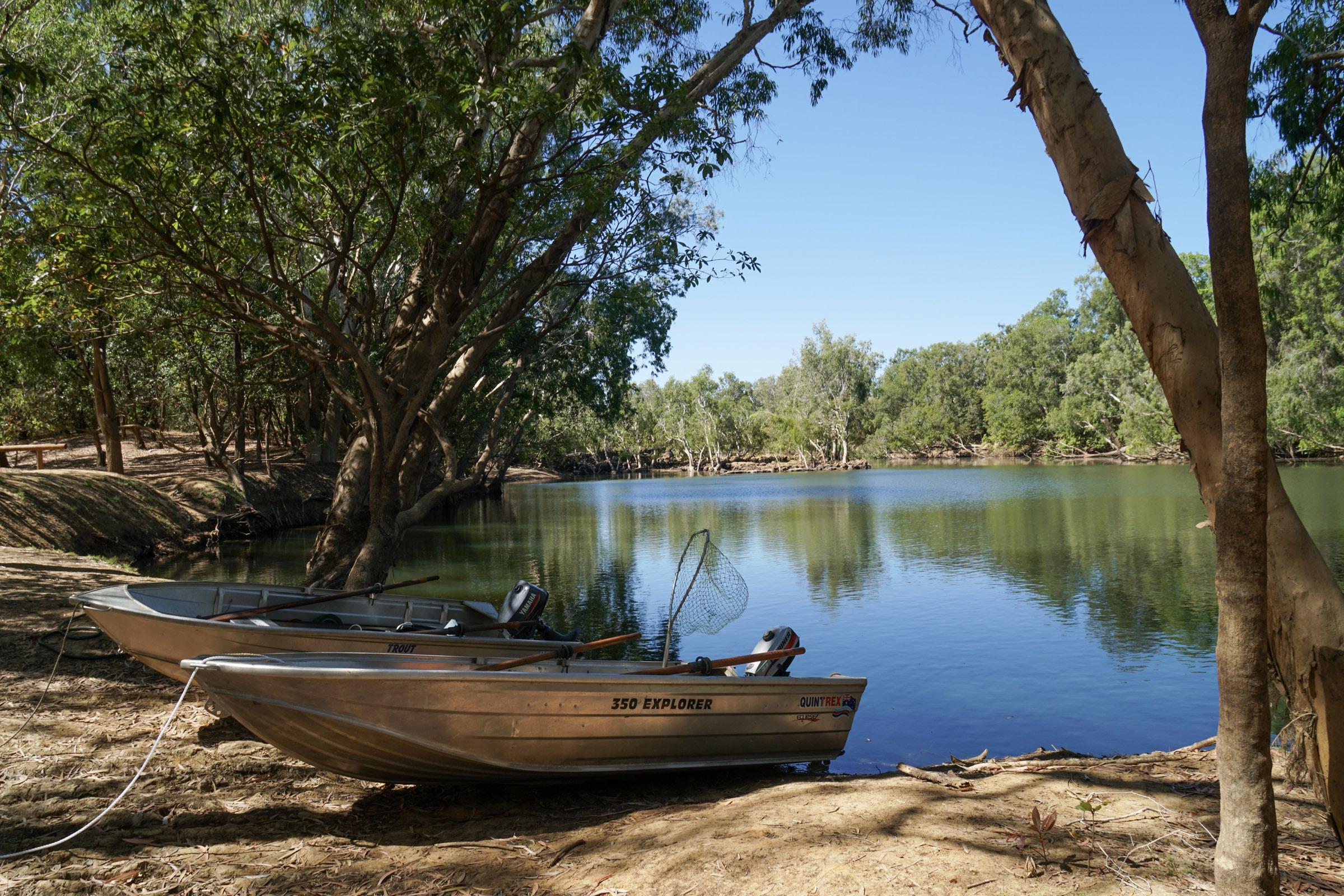
Days three and four were packed full of stops, detours, backtracking and innumerable campsites. We managed to stick to schedule, even if we did have to hustle at certain points. We came across a few fairly well set-up groups of anglers, all of whom told us theirs was the best site in the park. By midday Friday I was in a position to judge these claims, since I’d visited every one of the 200-odd campsites that Lakefield had on offer. But these things are subjective, and we came across so many picturesque spots that I’d say there are more than enough ‘best’ sites in the park to go around.
WHEN THE DUST SETTLES
With the Lakefield leg of this trip done and dusted we headed south. We stopped off in Cooktown so Bryce and Tim could stock up on supplies and pick up another couple of jerry cans to bump up the safety margin on Bryce’s calculations for the next leg. My companions were about to set off to Cape Melville, before heading back down the coast to drive the Bloomfield Track, CREB Track and record surrounding points of interest. First, they needed to lighten their load.
I was left at the Palmer River Roadhouse to wait for a bus back to Cairns, on which I discovered that the back seats of the LC79 are not the world’s most uncomfortable by a long margin.
I made the most of this time by processing a few of the hundred of photos I’d taken and, once my phone started to ping again, I caught up on a week’s worth of emails.
Before long the novelty of my first mapping journey had worn off. While I’d been in the bush, print deadlines crept closer and my desk beckoned. In a couple of weeks, Tim would be back in the office providing technical support to customers and Bryce would have to sort through three weeks’ worth of data with the GIS team before fine-tuning another multi-week mapping itinerary and hitting the road once more.
The reality is there’s no job here that allows day-in day-out four-wheel freedom, but that’s alright by us, because as far as I can tell, we all like what we do. I’m not a believer that if you love what you do it never feels like work. If the people around me are anything to go off, loving your work only motivates you to work harder to achieve the best possible results and give back to the company and co-workers that make it just so.
For the majority of Hema employees, these kinds of trips are really just a bonus, and even then, they’re not guaranteed. But if you harbour any ambition of mastering the darks arts of cartography, have a GIS itch that needs scratching, speak the language of computers, build apps or do any of the other things far beyond my sphere that go on here, you could definitely do worse than scoring a spot at Hema.
There are aesthetically astute designers, manic marketers, decisive executives, suave sales folk, administrative life-savers and even a corner where the bean-counters lurk. It takes a lot of different skills to keep those Cooper S/T MAXXs turning, which is what I like to tell people when they ask.
But if you fancy yourself as an editorial asset and you’re thinking that my gig sounds like a bit of alright, I’m sorry to burst your bubble — I’m not planning to give it up any time soon.