The Victorian High Country covers over 1.2 million acres and is part of the Great Dividing Range. It's an important meeting place for Indigenous people from all over south-eastern Australia who would gather at the highest plains for trade and ceremonies. The region was also important for the cattle farmers who fattened their herds on the plentiful feed. Now the High Country is a magnet for camping, 4WDing, fishing, hiking, horse riding and mountain biking.
Being able to base camp and then explore the surrounding region is a great way to experience the High Country and, in some cases, throwing in a swag or tent to experience a sensational night or two camping atop a secluded mountain is something few get the chance to do.


CIRCUIT ROAD
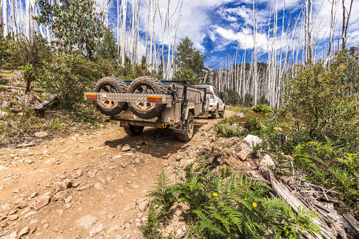
The Circuit Road is a seasonal gravel road that twists and winds its way around Mount Stirling. Accessed via the Mount Buller Road and Mount Stirling Road, it begins and ends at Telephone Box Junction, covering approximately 60km. We think you need to add a few more clicks to your adventure though, with a couple of detours to some iconic High Country huts, a pretend hut and the beautiful Bindaree Falls.
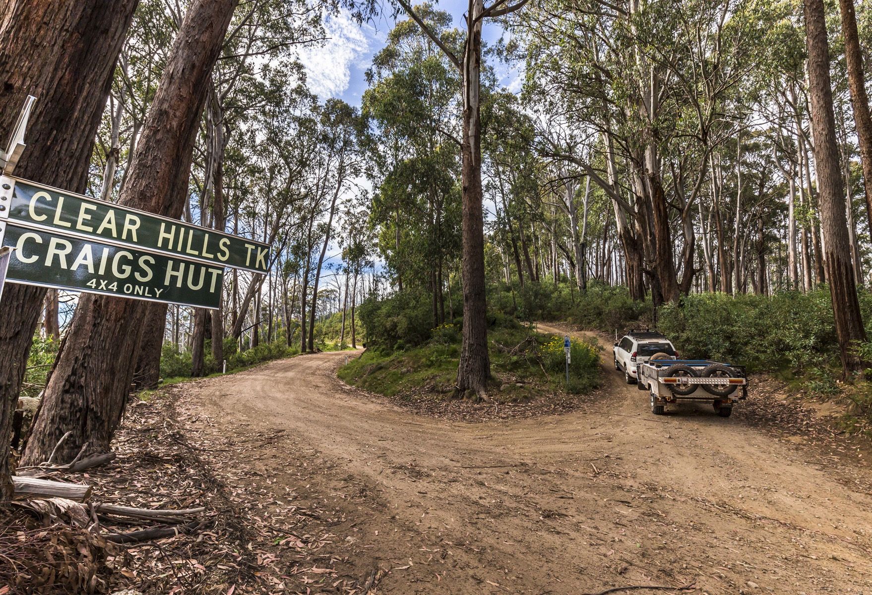
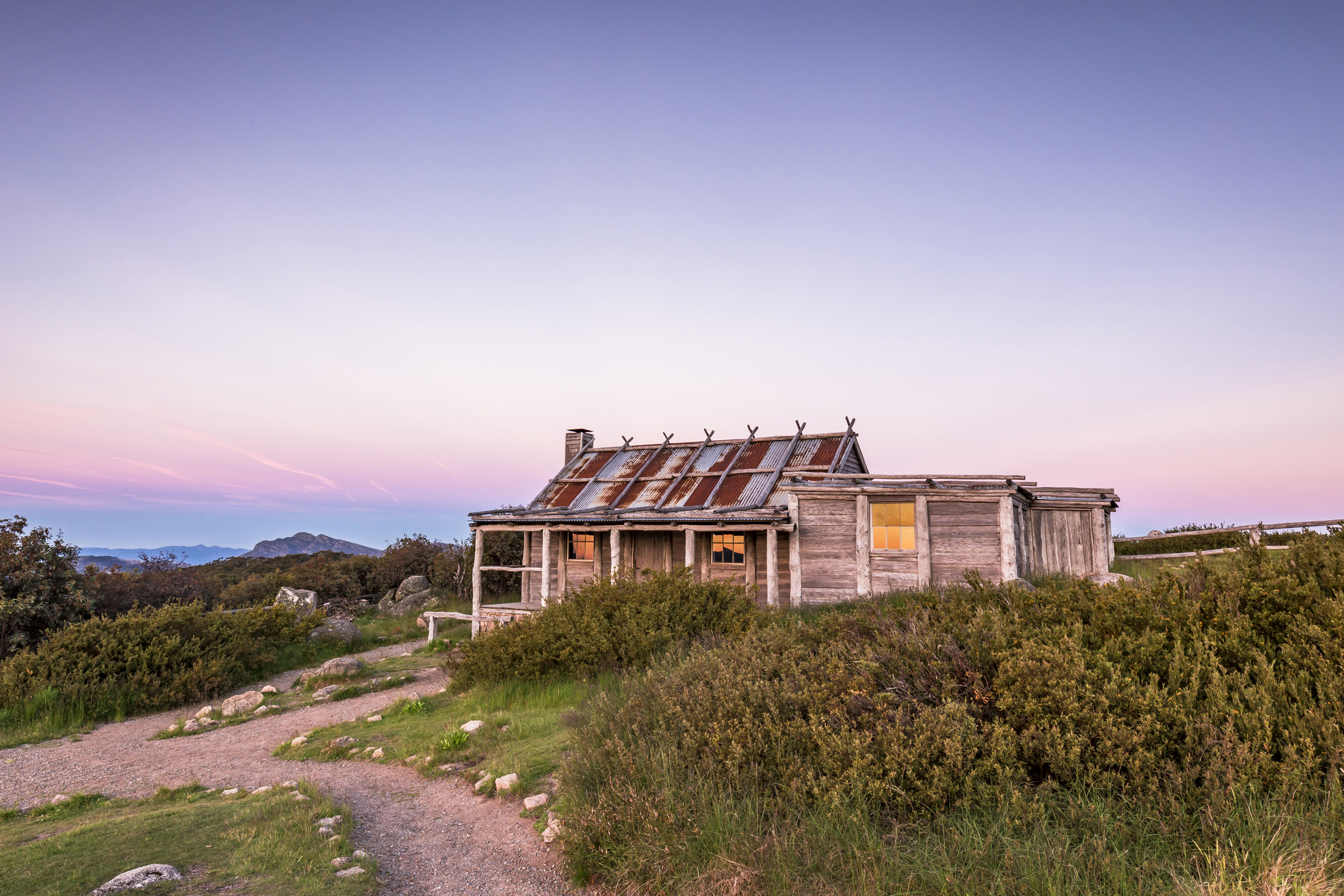
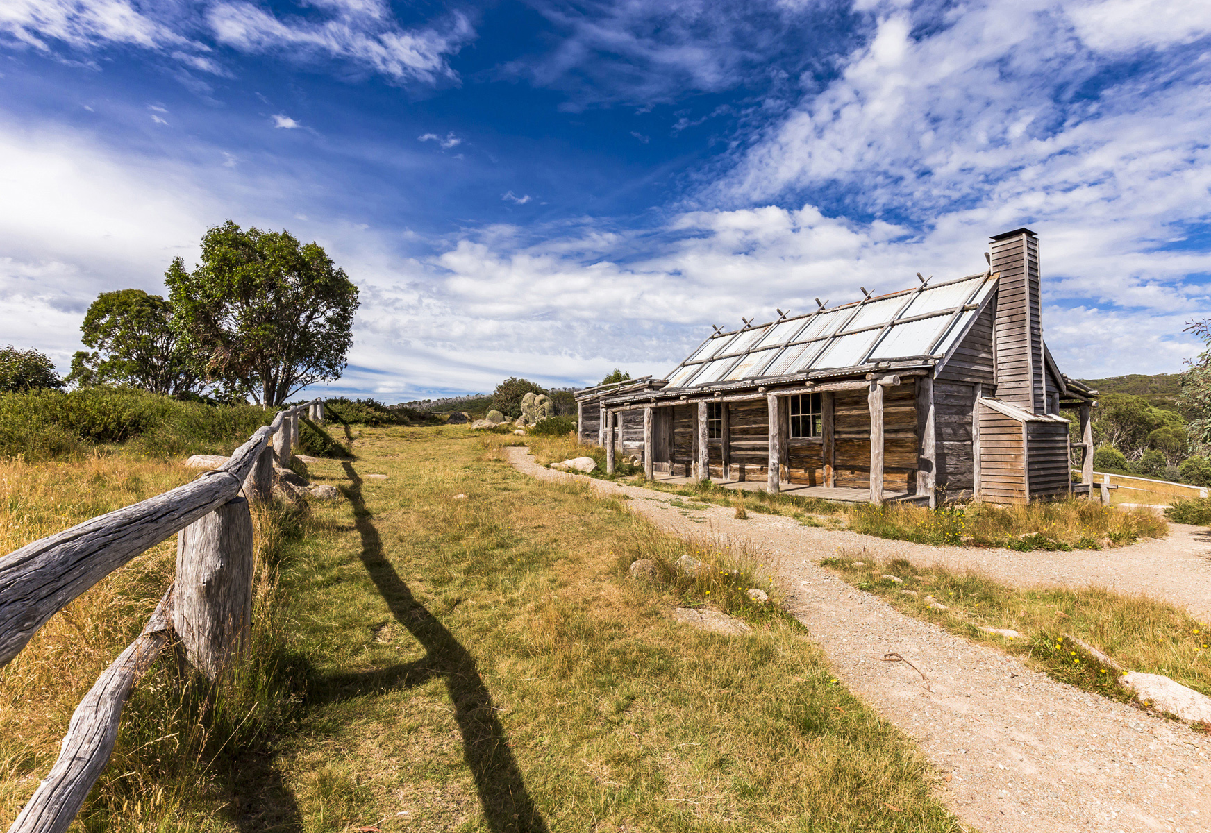
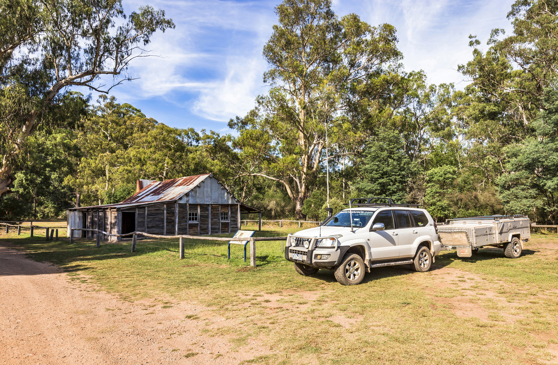
Razorback Hut is a collection of huts popular with horse trail riders, evidenced by the nearby yards, and is located just off the Circuit Road near King Saddle. The most visited hut in the High Country is accessed via Clear Hills Track — Craigs Hut. Built for The Man from Snowy River in 1981, the current version is number three thanks to bushfires and neglect. There’s also a good area nearby suitable for camper trailers, so why not spend the night?
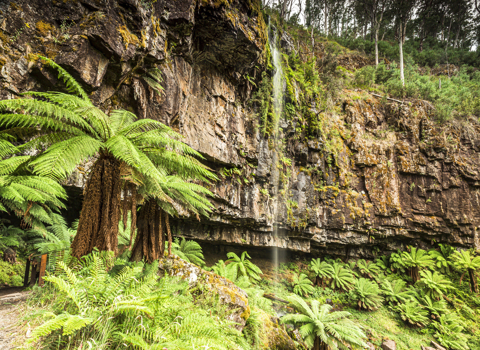
Back on the Circuit Road, at the junction with Monument Track and Bindaree Road, turn onto the latter down to the Bindaree Falls car park. The waterfalls are stunning, with ferns and moss enjoying the moisture, and getting in behind the cascade is perfect on a hot day, especially if the breeze is blowing just right.
Next stop is Bindaree Hut which looks like it was built for the dwarfs from Snow White. This is a nice quiet spot for camping beside the Howqua River and, if you continue further along the track, you’ll reach Pikes Flat Hut, renowned as a great fly-fishing spot. Returning to the Circuit Road, the final hut before Telephone Junction is Howqua Gap Hut, built in the late 1960s for logging operations.
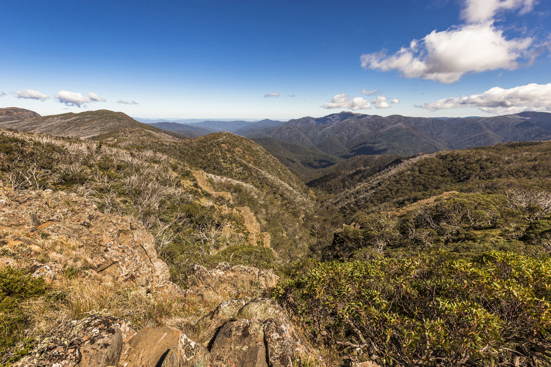
DARGO TO MOUNT HOTHAM VIA BLUE RAG
If given the opportunity to camp for free behind a quintessential High Country pub, the Dargo Hotel is the one we’d chose. From here the Dargo High Plains Road leads you north. Passing through the high plain property owned by the Treasures family, healthy Hereford cattle enjoying the lush feed. The Treasures have grazed cattle on the Dargo High Plains during summer since the 1880s. It won’t be long before you reach the turnoff to one of the High Country’s most iconic tracks — Blue Rag Range.
You’ll need to unhitch your camper here as the loose, rocky terrain hits as soon as you begin and isn’t suitable for a trailer. Upon reaching the first crest, you’ll be left breathless by one of the most amazing vistas. While the track isn’t as gnarly as it used to be, having felt the cut of a grader’s blade, don’t let this fool you as the track changes from season to season.
The final climb brings the trig point into sight and then as you park your rig for the Insta photo, the views will cause a distraction and won’t be easily forgotten. From here it’s an easy drive to Mount Hotham and the Great Alpine Road and onto great destinations such as Bright or Omeo.
TALBOTVILLE
Setting up the camper on the banks of the Crooked River in the Grant Historical Area is one of the best camping experiences you'll find. The old townsite at Talbotville offers an open plain with loads of space to set up, good swimming options and places to try your hand at fly fishing. Nearby you will find more old township sites as this was a busy gold mining area in the 1860s.
The Crooked River Track is an adventurous way of reaching the Dargo Hotel, with numerous water crossings of the Crooked and Wongungarra Rivers. Upon reaching the Kingwill Bridge, follow the Crooked River Road, winding and corrugated, to the Dargo Road before arriving at the Dargo Hotel.
By following the Crooked River Track upstream, you’ll discover the old town sites of Bulltown and then Stonewall before tackling a challenging climb up Bulltown Spur Track to McMillans Road. Turning right takes you back to Talbotville while a left turn leads towards the Grant township site and the Dargo Plains Road.
At the historic Grant Cemetery and old township, you’ll discover how strong and determined these people were. Facing harsh temperatures, tough working conditions and awful living standards they still worked the mines. In 1865, 15 pubs, a church, courthouse, police camp, medical centre, stores and town newspaper graced the township. By 1917 the place was empty. The last person, Mick Murphy, was taken to Dargo an ill man.
OMEO
One of the first regions settled in Victoria when in 1835 pastoralist George McKillop arrived from Monaro in New South Wales in search of new pasture for his cattle, with a member of his party James McFarlane settling the first cattle station in Victoria in nearby Benambra.
The following year the Pendergast brothers arrived and established Mount Leinster station. Alluvial gold was discovered in and around Livingstone Creek in 1851, and by 1854 more than 200 men were digging for gold.
There are a couple of camping options in and around Omeo that will allow you to set up base camp and explore the surrounding area. The Omeo Caravan Park is a beautiful spot to stake a claim and enjoy all the facilities you need, or the free campsite at the Victoria Falls Historic Area. A nice spot to camp, it’s suitable for all types of setups, with fire pits and pit toilets. The track continues to what’s left of the hydropower source for the Cassilis mine. You can also see Victoria Falls — the best time is in the afternoon when the sun highlights the view.
The Cassilis Historic Area situated between Omeo and Swifts Creek via Cassilis Road is where you’ll find the King Cassilis Mine and Treatment Works. It’s a great place to see how gold was extracted and processed in this remote, mountainous area.
Charlotte Spur Track is a great challenge, this steep and rocky track was once used by the stagecoaches and supply carts that used this route from Bairnsdale to Swifts Creek. The road was built up in places and the magnificent stonework walls are still evident. The Strobridge’s Huts lie deserted at the end of the track, slowly being enveloped by the bush, and were where the reclusive ‘Mad’ Lucy lived until she passed at the age of 81.
Another fantastic loop trail follows the Benambra-Corryong before turning onto Tablelands Road, reaching the Taylors Crossing ford across the Mitta Mitta River. Here you’ll find a swing bridge across the river and Kennedys Hut before tackling backtracks to make your way onto the Omeo High Plains, past the historical Hinnomunjie Bridge, and return to Omeo.
SHEEPYARD FLAT/FRY’S HUT
The campgrounds at Sheepyard Flat and Fry’s Hut are extremely popular, and it’s not hard to figure out why. The waters of the Howqua River flow gently past both areas and are a great place to hang out when the temperatures rise.
There are also some fantastic tracks to quench your 4WD thirst and plenty of High Country huts to check out too. Howqua Hills Track is a dry weather 4WD track that climbs up to Steiners Road. From there you can explore several tracks of varying difficulty that lead to Jamieson or Howqua.
By following Brocks Road to the Bluff Link Track, you’ll pass a few private huts along the Howqua River, before climbing to greater heights. Approximately 5km before the junction with Bluff Track is a car park from where you can hike 1.5km up to the Bluff summit.
The Bluff Track offers great views across to Mount Buller as you climb to Bluff Hut. The original hut was built in 1955 by Jack Ware and Eadley Stoney, who owned the cattle lease, with the Stoney family managing the lease until 2005. The hut was destroyed by bushfires in 2007, but was rebuilt later in the same year.
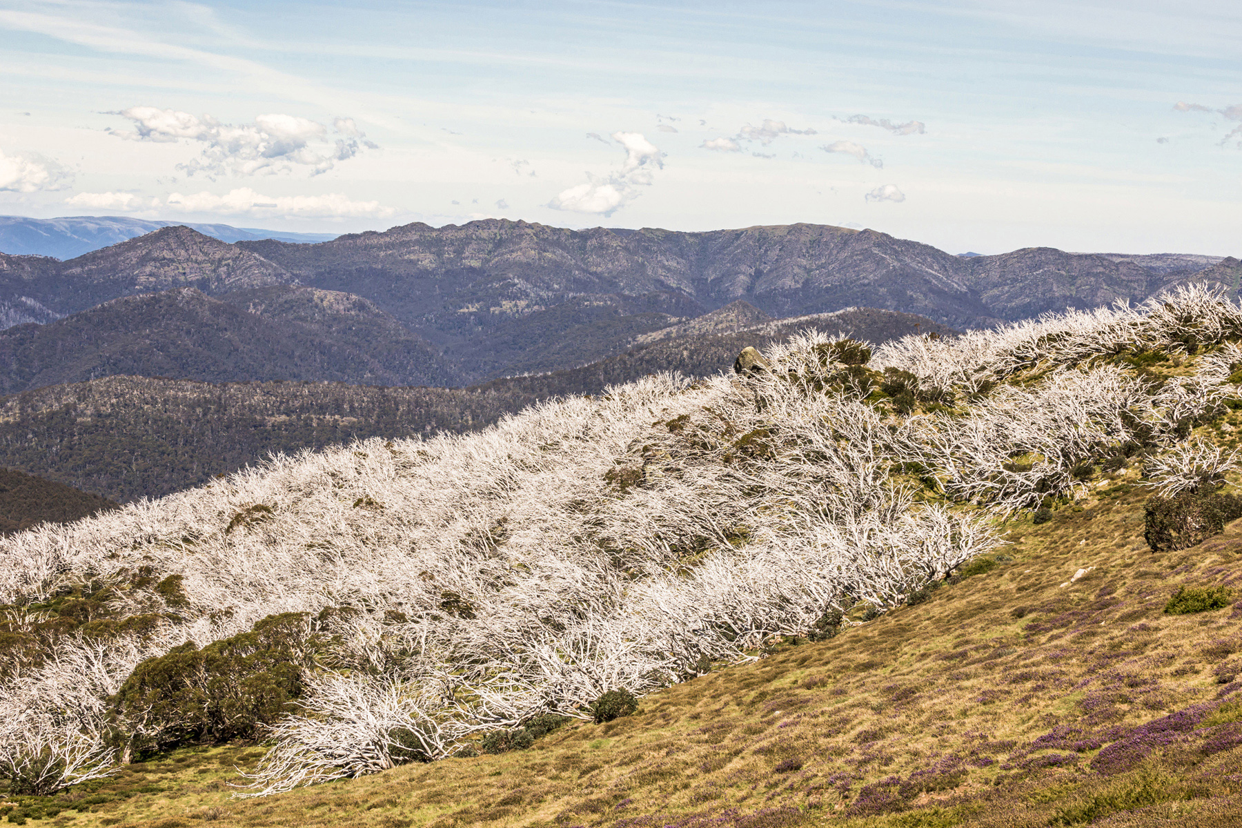
Beyond Bluff hut, you’ll experience stunning views across High Country plains, before reaching Lovicks Hut. The Lovick family built many huts as they also owned a cattle lease in this region. In 2006 the hut was rebuilt and is now popular with horse riders. Not far from Lovicks Hut is Picture Point. You’ll be blown away by the views from here. Just before the end of Bluff Track sits the King Billy Tree — it’s the oldest known snow gum in the Victorian High Country at over 500 years.
If you want to escape the crowds for a night, leave your camper at the campground and experience camping at Bluff Hut or Lovicks Hut where you’ll find some beautiful, soft high-country grass to roll your swag out onto. Best to check the weather before heading up though, as even in summer you can experience ice-cold conditions and even snow, especially being above 1500m.
TOM GROGGIN
Set on the banks of the Murray River, spread across open grassland, is the Tom Groggin campground and a great base camp. Access is via the Alpine Way from Thredbo in the east or Khancoban to the north. As well as the perfect place to enjoy mountain biking, fishing and bushwalking, it’s the challenging 4WD tracks that draw people to this special spot.
Spending a night on top of Victoria’s highest driveable mountain is the ultimate challenge and includes fording the Murray River and following the Tom Groggin Track, with a quick detour via Dogman’s Hut, before following the trail up to Mount Pinnibar Track.
It’s a relatively easy climb until you reach a height of 1500m, then you’ll be fighting for traction over the final 3km climb to the summit at 1772m. Once there, roll out your swag, light a fire to keep warm, and watch the sunset across the High Country and next morning, you’ll also get to enjoy the dawn of a new day. Before returning to Tom Groggin, a detour up to Mount Gobbo is highly recommended.
HOOKED FOR GOOD
There are plenty of forestry tracks throughout the Victorian High Country that are suitable for towing camper trailers, and they lead to some amazing campsites, too. A good guide is the Hema Explorer app. In most cases, the tracks rated as ‘Easy’ are suitable for trailers. Just remember that conditions can change very quickly in the High Country and what may be an easy run in the dry, can be dangerous in the wet.
BASE CAMP EXPLORING
By far the most popular way we use our camper trailers is by establishing a base camp before getting out and exploring what’s nearby. There are plenty of places in the High Country to do this, so it was difficult to whittle it down to just two. But we’re sure you’ll agree we picked some crackers.
BASE CAMP THEN SWAGGING IT ATOP A MOUNTAIN
If you’ve never camped above 1400m, the High Country is the perfect place to try it. Being so exposed can be intimidating, but it will be something you’ll cherish for years to come. Here are a couple of our favourite spots where you can experience high altitude bush camping.